Machine Learning
We think outside the dataset. Our machine learning team is ready to work toward finding solutions to your seemingly impossible questions. With a combination of artificial intelligence and machine learning tools, we’ll train models, generate predictions, and transform your data and Earth observation imagery to put you one step closer to the answers you need.
Examples of our capabilities
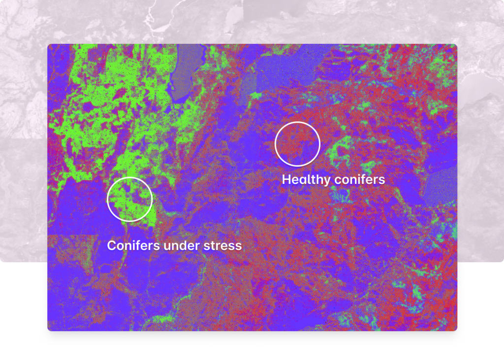
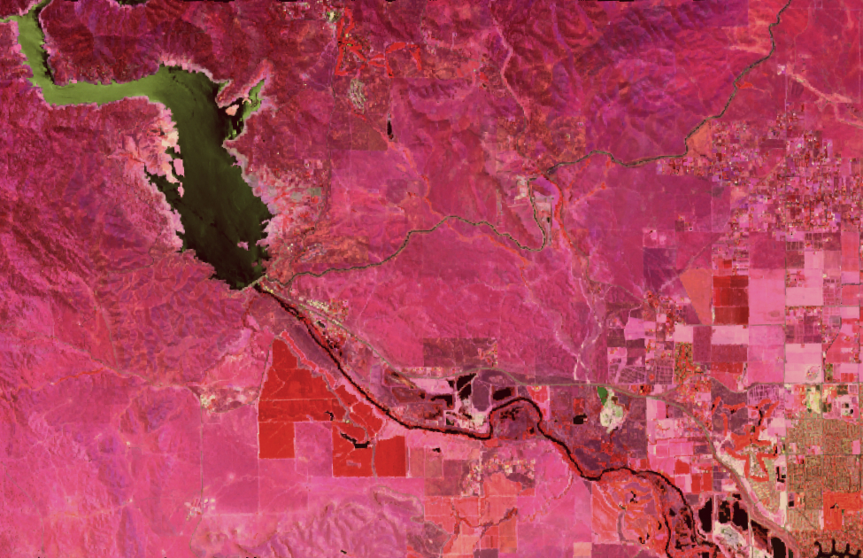
Tree health detection using hyperspectral imagery
Manually comparing spectral profiles is inefficient at scale. Using machine learning, we can train a model to identify the spectral characteristics of different materials. Our work on tree health in California used hyperspectral imagery to distinguish between healthy (green-stage) conifers and conifers under stress (red-stage). These results are from an ML model that works on 224-band AVIRIS imagery.
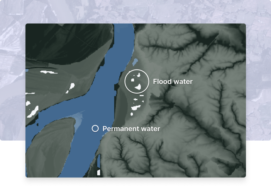
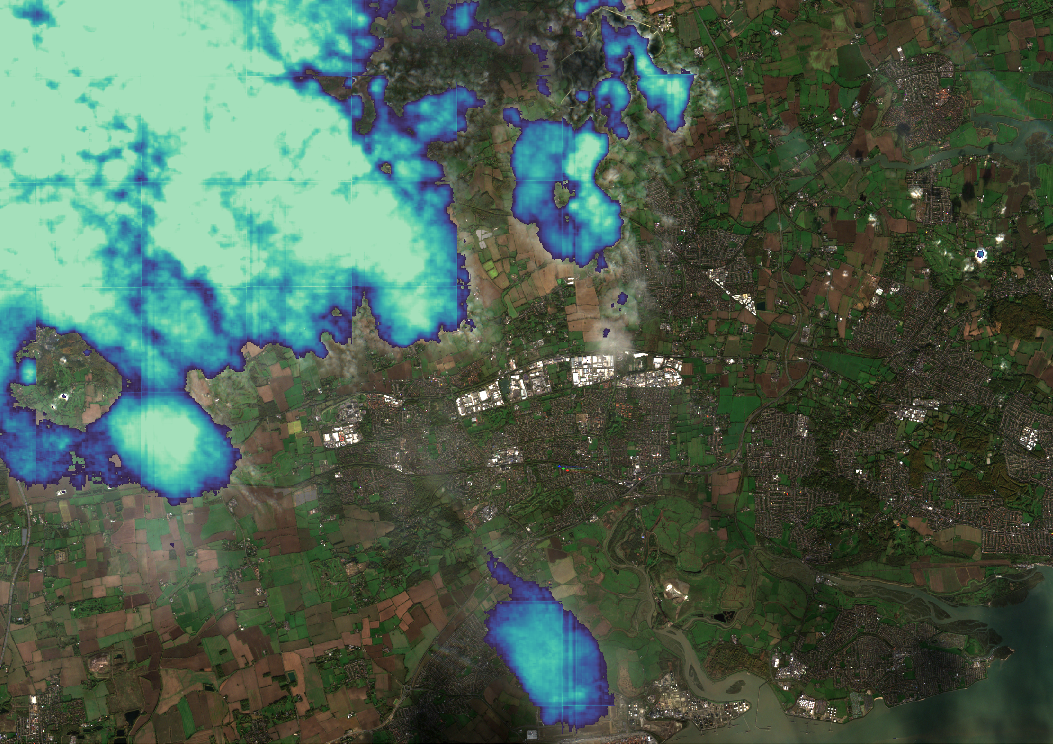
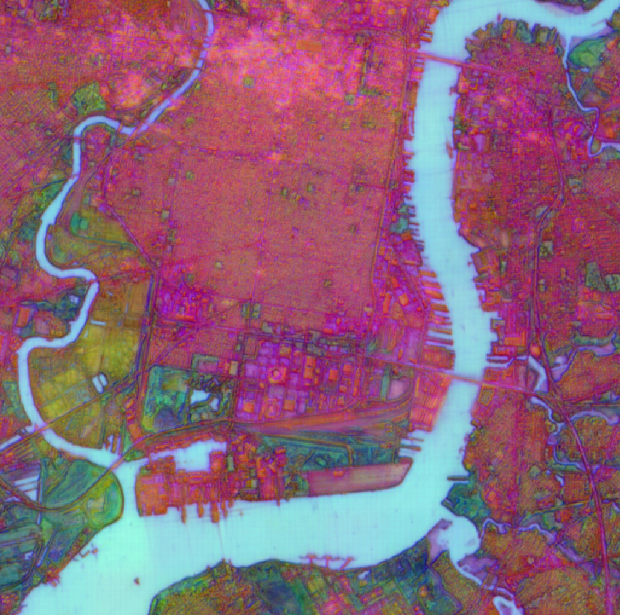
Distinguishing permanent water from flood water using SAR data
Our team’s work on the NOAA SBIR Project on Flood Inundation Mapping demonstrated the potential of machine learning techniques, such as CNNs and transfer learning, to analyze SAR data and create accurate flood inundation maps. The project highlights those techniques’ potential to contribute to more effective flood prediction and response efforts, ultimately benefiting communities at risk from flood events.
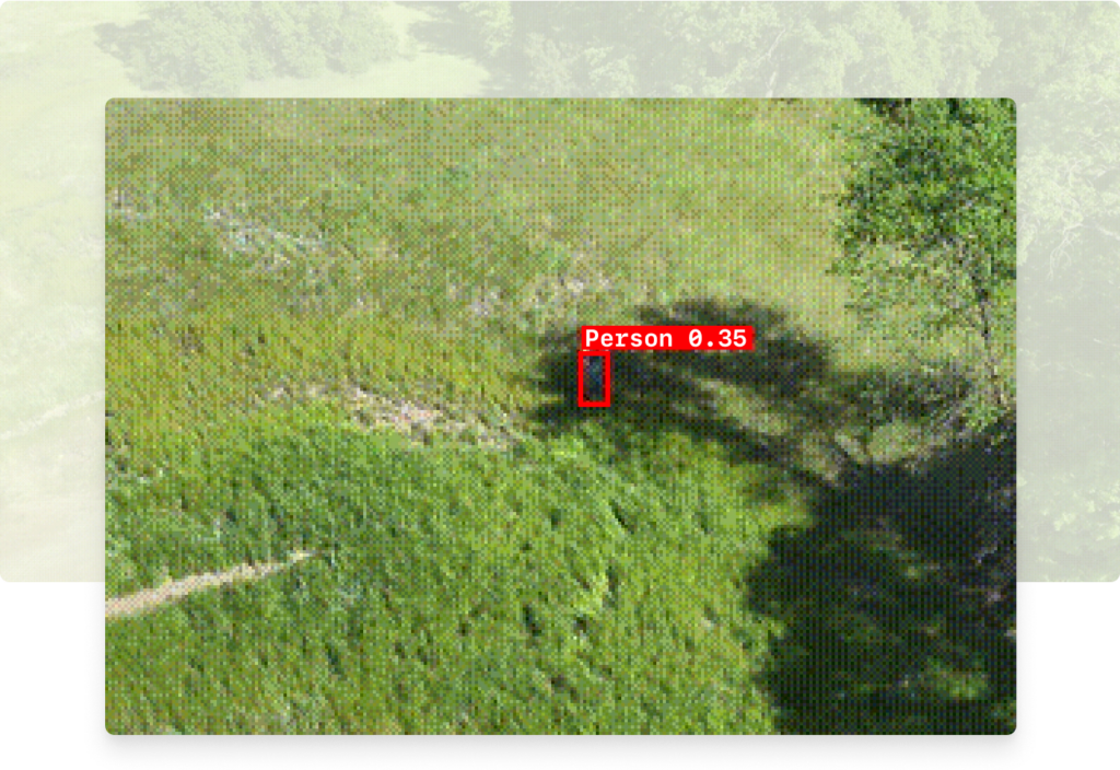
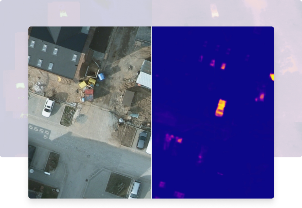
Near real-time edge processing of drone and aerial imagery for human identification
By leveraging machine learning and AWS Snowcone edge capabilities during austere operations, drone and aerial imagery can be processed in near real-time for search and rescue applications. The thermal detection stage has two parts: a traditional computer vision-based algorithm and an ML model. In the following optical detection stage, we run an object detection model on the segments of video identified by the thermal detection stage as likely to contain people.
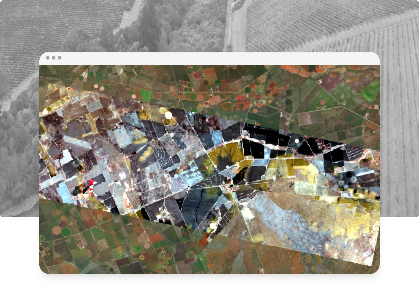
Implementing a Human-In-The-Loop workflow in GroundWork to speed up model training
As creators of both a geospatial annotation tool, GroundWork, and a geospatial deep learning library, Raster Vision, we found ourselves well-positioned to begin building out the HITL workflow. This is a bootstrapping approach in which the dataset and the model are built up incrementally together. Feedback from the model informs what to label next, which, in turn, improves the model, and so on until the desired dataset and model quality is achieved.
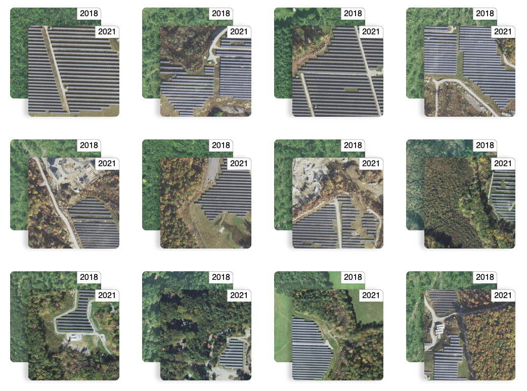
Other projects
More ->

Blog posts
More ->

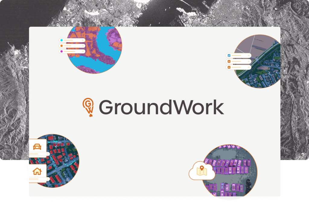
Our tooling
GroundWork ->
An annotation tool designed for geospatial data, including satellite, aerial, and drone imagery. GroundWork supports object detection, chip classification and semantic segmentation projects, ideal for creating training datasets for machine learning projects.
Raster Vision ->
Raster Vision is an open source library and framework that bridges the divide between the world of GIS and deep learning-based computer vision for satellite and aerial imagery.