Geospatial infrastructure
We specialize in cloud-native geospatial architecture, infrastructure, and scaling. Our team provides geospatial consulting and analysis including machine learning and large-scale data management expertise.


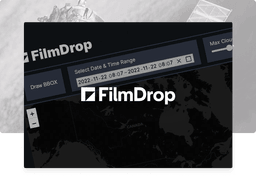
FilmDrop ->
Cloud-native geospatial processing suite.
FilmDrop is a suite of open source tools for ingesting, archiving, processing, analyzing and distributing geospatial data in the cloud.


Earth Search ->
Earth Search offers a public search and discovery API for Earth on AWS, Amazon‘s registry of open geospatial datasets. Initial datasets include the entire USGS Landsat Collection 2 and ESA Sentinel-2 catalogs, Sentinel-1, Copernicus DEM, and NAIP with more datasets being added regularly.
Powered by FilmDrop
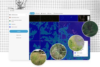
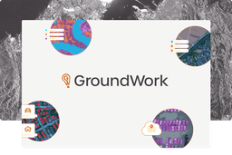
GroundWork ->
An annotation tool designed for geospatial data, including satellite, aerial, and drone imagery. GroundWork supports object detection, chip classification and semantic segmentation projects, ideal for creating training datasets for machine learning projects.

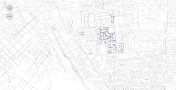
Raster Vision ->
Raster Vision is an open source library and framework that bridges the divide between the world of GIS and deep learning-based computer vision for satellite and aerial imagery.